
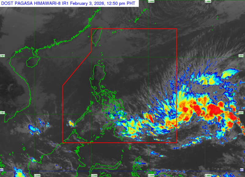
MANILA – A low pressure area (LPA) located outside the Philippine Area of Responsibility (PAR) is likely to develop into a tropical cyclone within the next 24 hours, the weather bureau said Tuesday.
As of 2 a.m., the LPA was spotted about 1,370 kilometers east of northeastern Mindanao. According to Philippine Atmospheric, Geophysical and Astronomical Services Administration (PAGASA) forecaster Chenel Dominguez, the weather system is also expected to enter PAR later in the day.
“If it develops into a tropical cyclone, it will be named Basyang,” Dominguez said, adding that the system may affect parts of the Visayas and Mindanao.
Meanwhile, much of the country will continue to experience rainy conditions. A shear line is expected to bring scattered rains and isolated thunderstorms over the Visayas, Caraga, Davao Region, and Misamis Oriental. PAGASA warned that moderate to heavy rainfall in these areas could trigger flash floods or landslides.
The northeast monsoon, locally known as amihan, will cause light rains over Batanes and the Babuyan Islands, as well as isolated light rains across the rest of Luzon.
The remainder of Mindanao will see isolated rain showers due to localized thunderstorms.
Moderate to strong winds and moderate to rough seas are forecast over Northern Luzon and the eastern sections of Central and Southern Luzon, Visayas, and Mindanao. Elsewhere, winds will be light to moderate, with slight to moderate coastal waters, PAGASA said. (PNA)