

Photos, maps, tables and technical information courtesy of Prof. Mahar Lagmay/UP Resilience Institute–Project NOAH, OCD Region III, DENR-MGB Region III and PDRRMO Bataan.
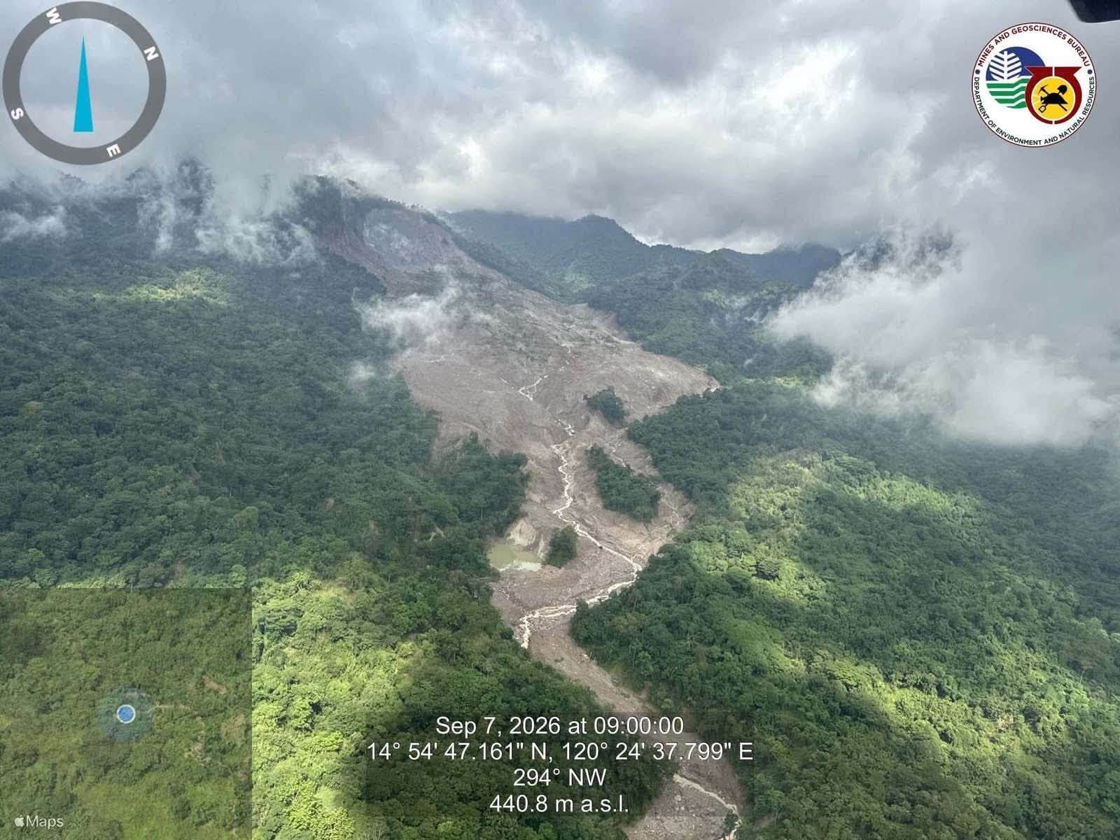
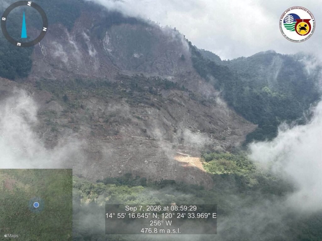
BATAAN — Authorities have warned of continuing landslide and debris-flow risks in downstream communities following a massive rainfall-triggered slope failure at Mt. Balikabok in Barangay Batiawan, Subic, Zambales, as large volumes of unstable debris remain on the mountain and along drainage channels.
The warning was issued following initial technical assessments by the UP Resilience Institute–Project NOAH, DENR-MGB Region III, Office of Civil Defense Region III and Bataan PDRRMO, which identified the Aug. 30 incident as an unusual “rainfall-triggered rockslide–debris avalanche–debris-flow–flood cascade.”
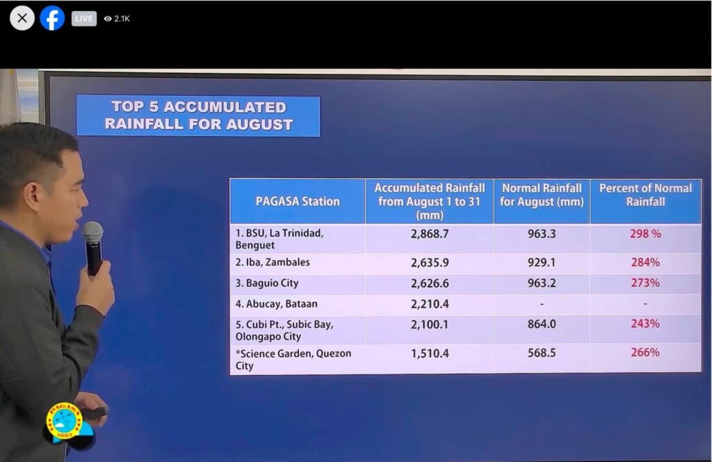
The assessment found that extreme rainfall had saturated the region before the slope failure. PAGASA’s Abucay station recorded 2,210.4 millimeters of rain in August 2026, more than 10 times the 203.8 mm recorded in August 2025 and nearly 4.5 times the 2021–2025 average.
By Aug. 27, accumulated rainfall had reached about 1,770 mm, followed by another 368.6 mm on Aug. 28–29.
Photos, maps, tables and technical information courtesy of Prof. Mahar Lagmay/UP Resilience Institute–Project NOAH, OCD Region III, DENR-MGB Region III and PDRRMO Bataan.
Although the Abucay station does not directly measure rainfall over Mt. Balikabok, a separate NOAH/GSMaP estimate placed precipitation on Aug. 28 at about 280 million cubic meters over roughly 1,400 square kilometers of mountainous terrain.
The rockslide-debris avalanche affected an estimated 1.8 million square meters, traveled 3 to 4 kilometers down the slope and displaced about 15 million cubic meters of material.
The debris entered the drainage network and traveled at least 10 kilometers before becoming a sediment-laden flood along the Pita-Dalao-Pagalanggang river system, putting communities in Dinalupihan at risk.
Authorities cautioned that the threat has not completely subsided. Remaining debris could be remobilized by intense or prolonged rainfall, while blockages could create temporary impoundments or landslide-dammed lakes that may suddenly fail and trigger downstream flooding.
Residents in affected areas, including Purok 5, Barangay Pita, have been advised not to return until authorities declare the areas safe.
Residents of Pita, Dalao, Pagalanggang, Old San Jose and other downstream communities are urged to avoid rivers, drainage channels and low-lying areas during heavy rains and follow disaster authorities’ advisories.
With Bataan Gov. Joet Garcia and Dinalupihan Mayor Tong Santos, authorities are seeking watershed-scale assessments, regular drone and satellite monitoring, and additional rainfall, river-level and ground-motion sensors to strengthen early warning systems. (Press Release)